
Hiking in Seoul: 6 City Mountains You Can Reach by Subway
Bukhansan, Inwangsan, Bugaksan, Namsan, Achasan and Gwanaksan: official trail times, subway access, park rules and safety tips for visitors.
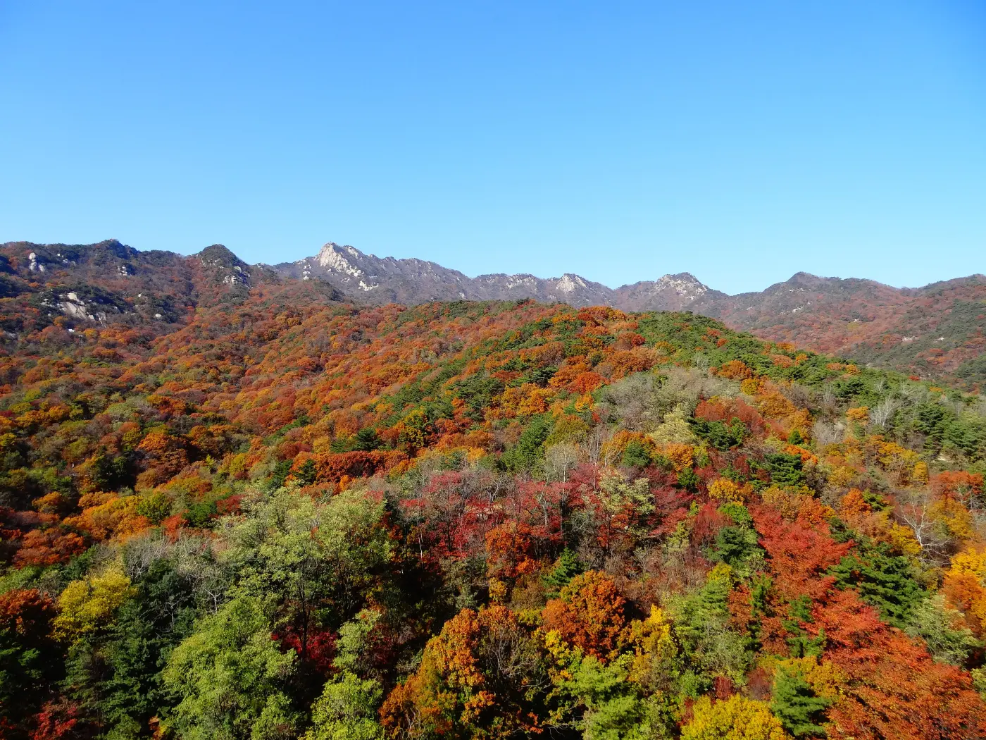
Seoul is one of the few capitals in the world where you can ride the subway to a granite summit, hike for a morning, and be back downtown for lunch. The old city was laid out inside a ring of four low mountains, and a much bigger range, Bukhansan, rises inside the city limits as a national park. On any weekend you will see Seoulites in full hiking kit on the trains heading north, east and south, and most of them are going to mountains you can reach for the price of a subway ride.
This guide covers six mountains that work well for visitors: Bukhansan, Bugaksan, Inwangsan, Namsan, Achasan and Gwanaksan. Distances, times and difficulty ratings come only from the official pages that publish them: the Korea National Park Service (KNPS) for Bukhansan, the Seoul City Wall site run by the Seoul Metropolitan Government for the four inner mountains, and the Seoul Trail site for Achasan and Gwanaksan. Where we give our own estimate, we say so. Note that the KNPS English site was not reachable when we checked in October 2026, so the Bukhansan figures below come from the KNPS Korean site.
The quick comparison
| Mountain / route | Difficulty (official) | Distance and time | Getting there |
|---|---|---|---|
| Bukhansan: Baegundae via Bukhansanseong course | Moderate; last 1.5 km moderate to difficult (KNPS) | 3.4 km, about 2 h 40 min up | Line 3 Gupabal Stn, then bus 704 or Yangju 37 to Bukhansanseong entrance |
| Bukhansan: Baegundae course from Ui-dong | Steep and rocky near the top, wire ropes on hard sections (KNPS) | 1.9 km, about 1 h 30 min up from the Baegundae trail centre, plus 2.0 km (30 min) of road from the Ui office | Line 4 Suyu Stn, then bus 120 to the Ui-dong terminus |
| Bukhansan: Daenammun course | Easier than other Bukhansan courses, but long (KNPS) | 5.8 km, about 3 h up | Same as Bukhansanseong course |
| Bugaksan: City Wall Baegak section | 5 stars, joint toughest of the wall's sections | 4.7 km, about 3 h | Line 3 Gyeongbokgung Stn Exit 3, then bus 7212, 1020 or 7022 to Jahamun-gogae (Changuimun) |
| Inwangsan: City Wall Inwang section | 5 stars, joint toughest | 4.0 km, about 2 h 30 min | Line 5 Seodaemun Stn Exit 4 (Donuimun site) or Line 3 Dongnimmun Stn Exit 2 |
| Namsan: City Wall Namsan section | 3 stars | 6.7 km, about 3 h (Korean page: 3 h 30 min) | Line 3 Dongguk Univ. Stn Exit 5 or Line 3/4 Chungmuro Stn Exit 4 |
| Naksan: City Wall Naksan section (easy option) | 2 stars | 3.2 km, about 1 h (Korean page: 1 h 30 min) | Line 4 Hyehwa or Hansung Univ. Stn |
| Achasan: Seoul Trail Course 5 | Intermediate (2 of 3) | 4.6 km, about 2 h 10 min | Line 7 Sagajeong Stn Exit 4; ends at Line 5 Gwangnaru Stn Exit 1 |
| Gwanaksan: Seoul Trail Course 11 (foothills) | Intermediate (2 of 3) | 5.7 km, about 2 h 30 min | Line 2/4 Sadang Stn Exit 4; ends at Sillim Line Gwanaksan Stn Exit 1 |
Two things to keep in mind when reading the table. First, the KNPS times for Bukhansan are for the climb only; you need to add the walk back down, and on a busy weekend the queue near the summit can add more. Second, the City Wall and Seoul Trail times are for walking the whole section end to end, so you can shorten them by joining or leaving at a station partway along.
Bukhansan National Park: the big one
Bukhansan is the mountain that serious Seoul hikers talk about. Its highest peak, Baegundae, stands at 836.5 m according to KNPS, and a Korean flag flies on the bare granite summit all year round. The park also contains the walls and gates of Bukhansanseong, a Joseon-era mountain fortress, and many temples, so even the approach walks pass through history.
For a first visit, KNPS describes two classic ways up to Baegundae. The Bukhansanseong course starts at the Bukhansanseong trail support centre in Eunpyeong-gu, passes the Daeseomun gate and climbs 3.4 km to the summit in about 2 hours 40 minutes. The first part is a gentle paved road; KNPS warns that the second half turns into steep stone steps, and that the roughly 500 m below the Baegunbongammun gate is the hardest stretch of the route. The Baegundae course from Ui-dong on the eastern side is shorter on the mountain itself, 1.9 km and about 1 hour 30 minutes from the Baegundae trail support centre, but you first walk about 2 km of road from the Ui office to reach it. Near the top there are stretches of steep rock where wire ropes have been fixed for support.
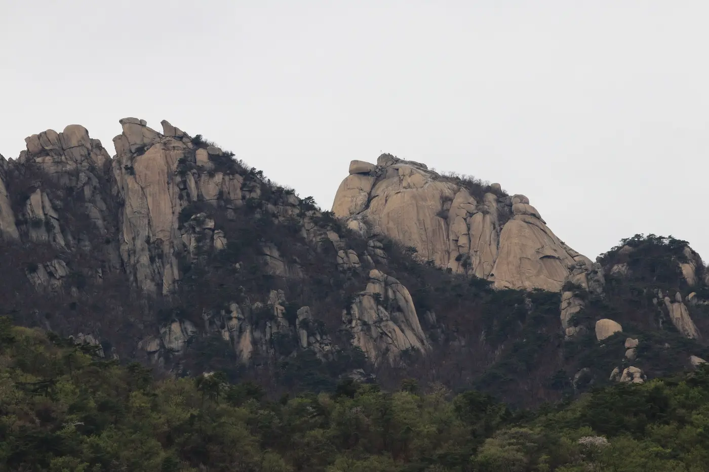
If you would rather see the fortress than stand on the highest point, the Daenammun course follows the valley inside Bukhansanseong past the Junghwangmun gate to Daenammun, the fortress's southern gate. KNPS calls it easier than the park's other courses, but it is 5.8 km one way, about 3 hours up. Another short option on the southern side is the Bibong course, 2.0 km and about an hour to the ridge. One rule surprises visitors here: KNPS states that the Bibong peak itself is a fall-risk zone that only people carrying a helmet, rope and descender may climb. Most hikers enjoy the view from the ridge below.
KNPS is blunt about weekends at Baegundae. It notes that the trail is rocky, steep below the summit, and crowded on weekends, so reaching the top can take much longer than expected, and it asks hikers to plan around their fitness and the sunset time. If you can only go once, a weekday morning is the gentlest introduction.
Entry hours and closures in the national park
Korean national parks use an entry time system. KNPS explains that it sets entry and cut-off times for each trail based on the destination, distance and walking time, and it has applied the system in every national park except Taean Coast since 16 May 2015. For Bukhansan, the KNPS table lists the same window for the main trails, including the Baegundae and Bukhansanseong routes: you may start from 04:00, and the cut-off is 16:00 from December to February and 17:00 from March to November. After the cut-off you will be turned back at the control point, even if the summit looks close.
Sections also close for repairs, weather or safety. A recent example: KNPS closed the 0.3 km stretch from Baegunbongammun to the Baegundae summit for maintenance from 28 September 2026, and reopened it early, at 04:00 on 2 October 2026. Closures like this are posted on the KNPS trail control page and the park's notice board, so check both on the morning you go.
Bugaksan, Inwangsan and Namsan: hiking along the city wall
The other four inner mountains of old Seoul are joined by Hanyangdoseong, the Seoul City Wall, and walking the wall is one of the most rewarding city walks in Korea. The official City Wall site splits the circuit into sections and rates them with stars. Baegak (Bugaksan, 342 m) and Inwang (Inwangsan, 339 m) both get five stars, the joint highest; Namsan gets three and Naksan two. Think of the stars as a comparison between sections: a five-star section here is a short, steep city hike with a lot of stairs, not a mountain expedition.
Bugaksan has a particular history. After North Korean commandos infiltrated Seoul in January 1968, public access was restricted for about forty years, and the Baegak trail only reopened in 2007, according to the City Wall site. Because the mountain rises directly behind the presidential compound at Cheong Wa Dae, access rules here have changed more than once over the years. When we checked in October 2026, the official Korean page listed the Baegak section as open 24 hours a day, every day of the year, with free self-guided entry, and marked the information centres at Changuimun and Malbawi as closed. Stay on the signed wall path and follow any posted notices or staff instructions. The same page recommends walking in daylight hours by season: 09:00 to 17:00 from November to February, 07:00 to 18:00 in March, April, September and October, and 07:00 to 19:00 from May to August.
Inwangsan is the rockiest of the four, known for oddly shaped boulders, and it was itself closed after 1968 until 1993. The City Wall site warns that its many rocky sections need extra care, especially in winter. From the summit you look east over Gyeongbokgung Palace and the old city, a lot of view for a short climb. Namsan is the gentlest of the three; its wall section climbs through Namsan Park to the summit with N Seoul Tower, and you can easily turn it into a half-day walk from Myeongdong or Chungmuro.
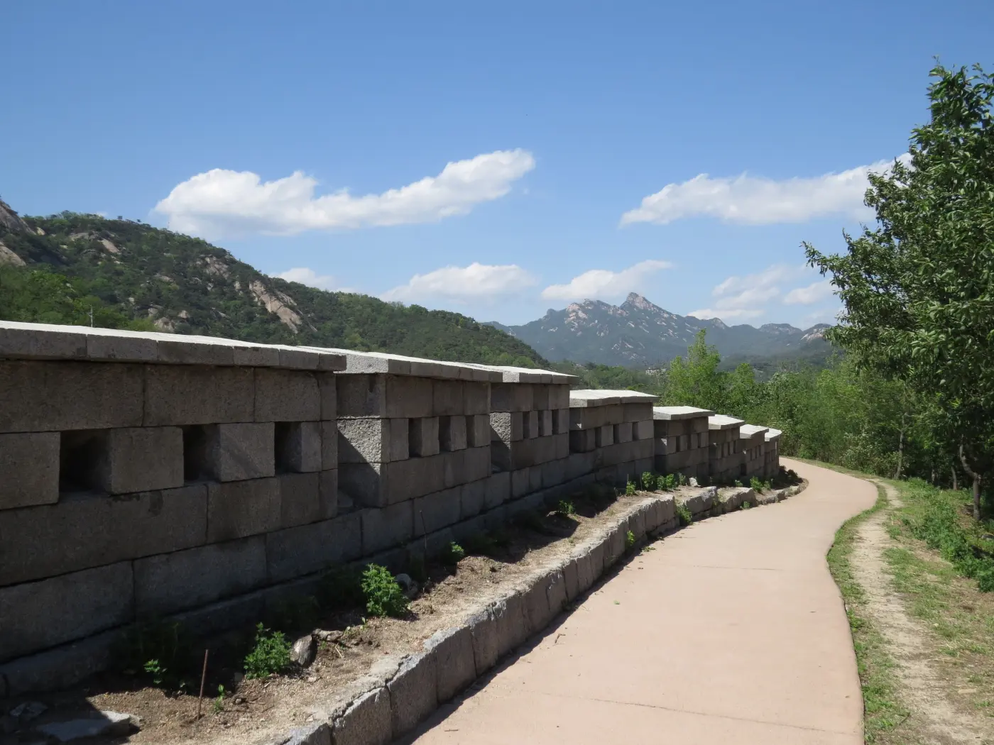
Practical tips from the City Wall site are worth taking seriously. There are no convenience stores on the Baegak and Inwang sections, so bring water and a snack. Once you set off on either section, there are no toilets for about two hours. Several stretches pass through residential neighbourhoods, and the site asks walkers to keep their voices down there and to walk in single file where the path is narrow or rocky. Do not climb on the wall itself.
Achasan: the easiest big view in the east
Achasan, on the eastern edge of Seoul in Gwangjin-gu, is a good choice if you do not usually hike. The Seoul Trail site gives its height as 295.7 m and describes Course 5 as a well-maintained, comfortable trek with excellent views. The official route runs 4.6 km from the Kkalddak-gogae rest area to Gwangnaru Station, takes about 2 hours 10 minutes, and is rated intermediate, two out of three. You can start from Sagajeong Station on Line 7 (Exit 4) and finish at Gwangnaru Station on Line 5 (Exit 1).
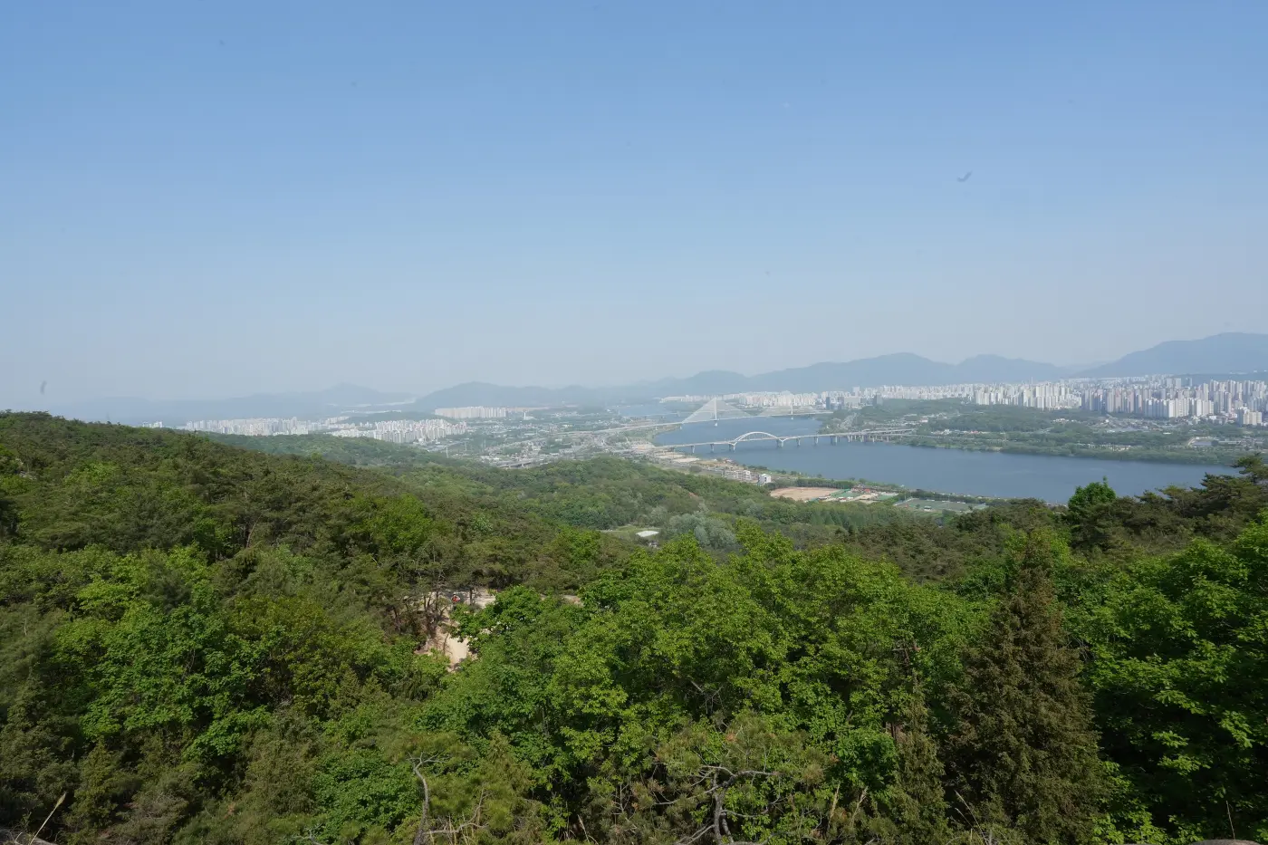
Along the ridge are the remains of small hilltop forts, known as boru, that the Seoul Trail site dates to the Three Kingdoms period and links to Goguryeo's hold on the Han River basin in the late 5th to mid-6th century. The site also notes a sunrise square on Achasan that is famous for New Year sunrise viewing, and the Goguryeojeong pavilion, a viewpoint for both sunrise and night views. If you want one sunrise hike in Seoul, this is the one.
Gwanaksan: rocky ridges south of the river
Gwanaksan, on the border of Seoul with Anyang and Gwacheon, is the highest mountain south of the Han River at 632.2 m, according to the Seoul Trail site. It is famous for its rocky ridgelines and for Yeonjudae, a small hermitage built on a cliff edge near the summit. The Seoul Trail's Course 11 is the official route we can give figures for: 5.7 km along the northern foothills from Sadang Station to the Gwanaksan Park entrance, about 2 hours 30 minutes, rated intermediate. It does not go to the summit.
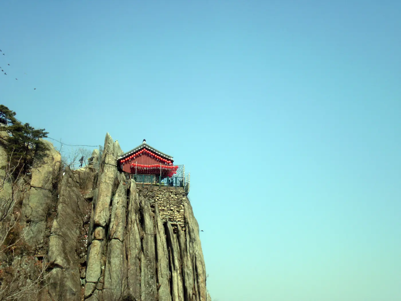
The summit routes to Yeonjudae are steeper and rockier, and the official city pages we checked did not publish a time for them. Our own estimate, not an official figure: allow at least half a day for a summit round trip, start in the morning, and turn back if you reach mid-afternoon without seeing the top. This is not the mountain for your very first hike in Korea.
Korean hiking culture: what you will notice
The first thing visitors notice is the gear. Many Korean hikers, especially older ones, wear technical jackets, trekking poles and proper boots even on city mountains. You do not need to match them, but the advice from both KNPS and the City Wall site is the same: wear hiking shoes or cushioned trail shoes, carry a layer, and in winter bring gloves and crampon-style traction (aijen), because KNPS says the main Bukhansan routes have many icy sections. Breathable clothes are better than cotton, which the City Wall site points out stays damp with sweat.
The second thing is food. Sharing snacks on a rock with a view is part of the culture, and eating a packed lunch is fine. Cooking is a different matter: the Natural Parks Act bans cooking outside designated places in natural parks, which includes Bukhansan. The same law bans drinking alcohol in shelters and in places the park authority designates, such as trails and summits, to prevent accidents, and those places must be signposted. Smoking outside designated places is also banned. When we checked law.go.kr in October 2026, the Act set maximum fines of 200,000 won for illegal cooking, drinking in a banned spot or littering, 500,000 won for entering a closed area or camping outside designated sites, and 2,000,000 won for smoking outside a designated place. City-run mountains post their own notices; read the signs at the trailhead.
The third thing is the after-hike meal. Trailheads like Bukhansanseong and Ui-dong have outdoor shops and places to eat clustered around them, and many hikers treat a big lunch at the bottom as the real summit. Remember the drinking rules on the mountain itself, and save the celebration for the table. Our guide to drinking rules explains the general laws.
Seasons and air quality
Spring and autumn are the classic hiking seasons, and autumn is also the busiest: KNPS publishes crowd safety notices for the foliage season, when narrow ridges and summits fill up. Summer is hot and humid, with heavy rain in the monsoon period, so start early and carry more water than you think you need. In winter, the KNPS warnings about ice apply to every rocky route in this article, and the entry cut-off at Bukhansan moves an hour earlier from December to February.
Check the air before you go. On days with high fine dust, a strenuous climb is not much fun, and the views vanish. Our fine dust guide explains how to read the forecast and what locals do on bad days.
Safety: sunset, staying on the trail, and 119
- Plan around sunset. Every KNPS course page we read tells hikers to factor in the sunset time, and autumn and winter days are short. Aim to be on your way down by mid-afternoon.
- Stay on marked trails. KNPS says the off-limits zones around Baegundae carry a high risk of falls and of lightning strikes, and entering a closed area is a finable offence under the Natural Parks Act.
- Check closures on the day: the KNPS trail control page for Bukhansan, and the City Wall site for the wall sections.
- Go to the toilet before you start, especially on the Baegak and Inwang sections, where the City Wall site says there are none for about two hours.
- In an emergency, call 119 for fire and rescue or 112 for the police. The Ministry of the Interior and Safety says calls to either number share your report and location with the other emergency services. 110 is the government helpline for non-emergencies.
- Tell someone at your hotel or a friend which route you are taking, and keep your phone charged.
A simple plan for your first Seoul hike
If you have one free morning and normal fitness, start with Inwangsan or Achasan: both are short, served by the subway, and give you a big view for the effort. If you have a full day and like a challenge, take Line 3 to Gupabal and do the Bukhansanseong course to Baegundae on a weekday, starting early so you are well inside the entry window. For something gentle, walk the Naksan or Namsan sections of the City Wall in the late afternoon and end with dinner in the city. These are our suggestions, not official recommendations, but every route above can be reached without a car or a tour.
For getting to the trailheads, our transport guide covers T-money cards, transfers and buses, and our emergency page lists the numbers worth saving before you go.
Comments
Sign in to leave a comment.
Sign in ·No account? Create one
Confirm your email address to comment — it takes one click.
No comments yet.