
Sokcho and Seoraksan: A 2-Day Trip from Seoul
How to reach Sokcho and Seoraksan by bus, which trails suit you, seasonal closures, and a simple one-night plan for the mountain and the harbour town.
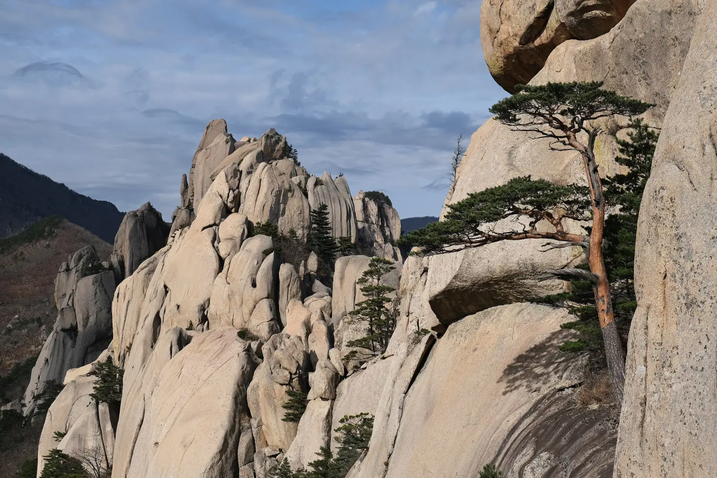
Most first trips to Korea stay inside Seoul, with perhaps a day out to a palace town or an island. Sokcho is the step beyond that: a fishing town on the north-east coast of Gangwon, sitting between the sea and the granite peaks of Seoraksan National Park. In one overnight trip you can walk a mountain trail in the morning, eat by a harbour in the evening, and be back in Seoul the next day.
This guide covers the practical side for foreign visitors: how to get there by bus, how to reach the park from town, which trails suit which kind of walker, the seasonal trail closures that catch people out, and the handful of places in Sokcho itself that are worth your time. Trail distances, times and closure rules below come from the Korea National Park Service (KNPS) and Sokcho City's own pages, which are linked at the end.
Sokcho and Seoraksan at a glance
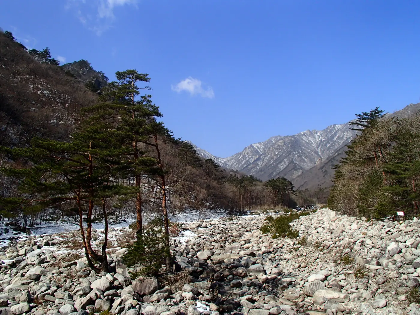
Sokcho City describes Seoraksan as Korea's fifth national park, designated in 1970, and the first place in the country to be named a UNESCO biosphere reserve, in 1982. Its highest peak, Daecheongbong, rises to 1,708 metres, and the city notes that the name "Seorak", roughly "snowy peaks", comes from how long the summit stays under snow each year. You do not need to climb anywhere near that high. The part of the park most visitors see is Seorak-dong, the valley entrance on the Sokcho side, where a cluster of short and medium trails starts from the same small park, called Sogongwon.
Sokcho town is about a twenty-minute bus ride from that entrance. It is compact: the express bus terminal, the beach, the main market, Abai Village and the harbour are all within walking distance or a short taxi ride of each other. That combination of mountain and town in one small area is what makes a two-day trip work without a car.
Getting there from Seoul
The standard public-transport route is the bus. The KNPS transport page for Seoraksan lists two departure points in Seoul: the express bus from Seoul Express Bus Terminal in Gangnam to Sokcho Express Bus Terminal, and the intercity bus from Dong Seoul Bus Terminal to Sokcho Intercity Bus Terminal. Sokcho City's transport page names the same two routes and notes that the buses use the Seoul–Chuncheon expressway and the Misiryeong tunnel. The two official pages give slightly different journey times, so plan on a little over two hours from Dong Seoul and under three hours from the Gangnam terminal, depending on traffic. Buses can sell out on weekends and in the autumn foliage season, so book a return seat in advance if your dates are fixed.
The two Sokcho terminals are not the same building. The express bus terminal sits close to the beach; Sokcho City says Sokcho Beach is about five minutes on foot from it. The intercity terminal is a separate building elsewhere in town, so check which one your ticket uses. Both are served by local buses and taxis, and either works as a base. If you are new to Korean buses, our guide to getting around Korea explains how express and intercity buses, T-money cards and seat booking work.
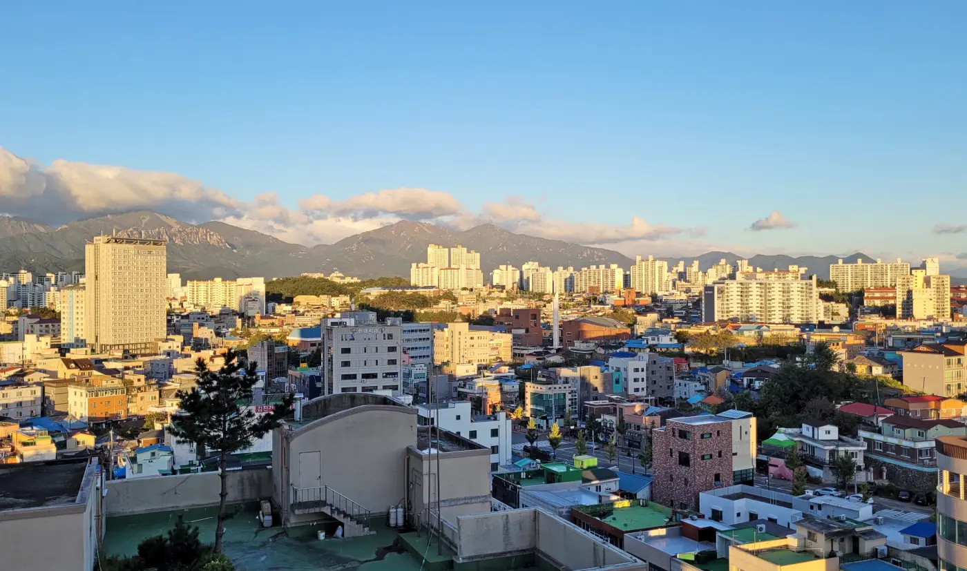
From Sokcho to the park: city buses 7 and 7-1
Both official sources name the same buses. Sokcho City lists routes 7 and 7-1 as its Seoraksan-bound city buses, and the KNPS transport page gives the journey as city bus 7 or 7-1 to the Sogongwon car park, followed by a three-minute walk to the Seorak-dong visitor support centre where the trails begin. KNPS puts the ride at about 20 minutes from the express bus terminal and about 30 minutes from the intercity terminal. Sokcho City publishes the timetable for each route as a download on its transport page, and a free public-transport helpline (080-850-9486, weekdays 09:30 to 17:30) is listed there as well.
The last stop is busy in October and November, especially on weekends. Starting early gives you a quieter walk and more daylight to finish the longer trails, which matters for the entry rules covered below.
Sinheungsa: the temple at the entrance
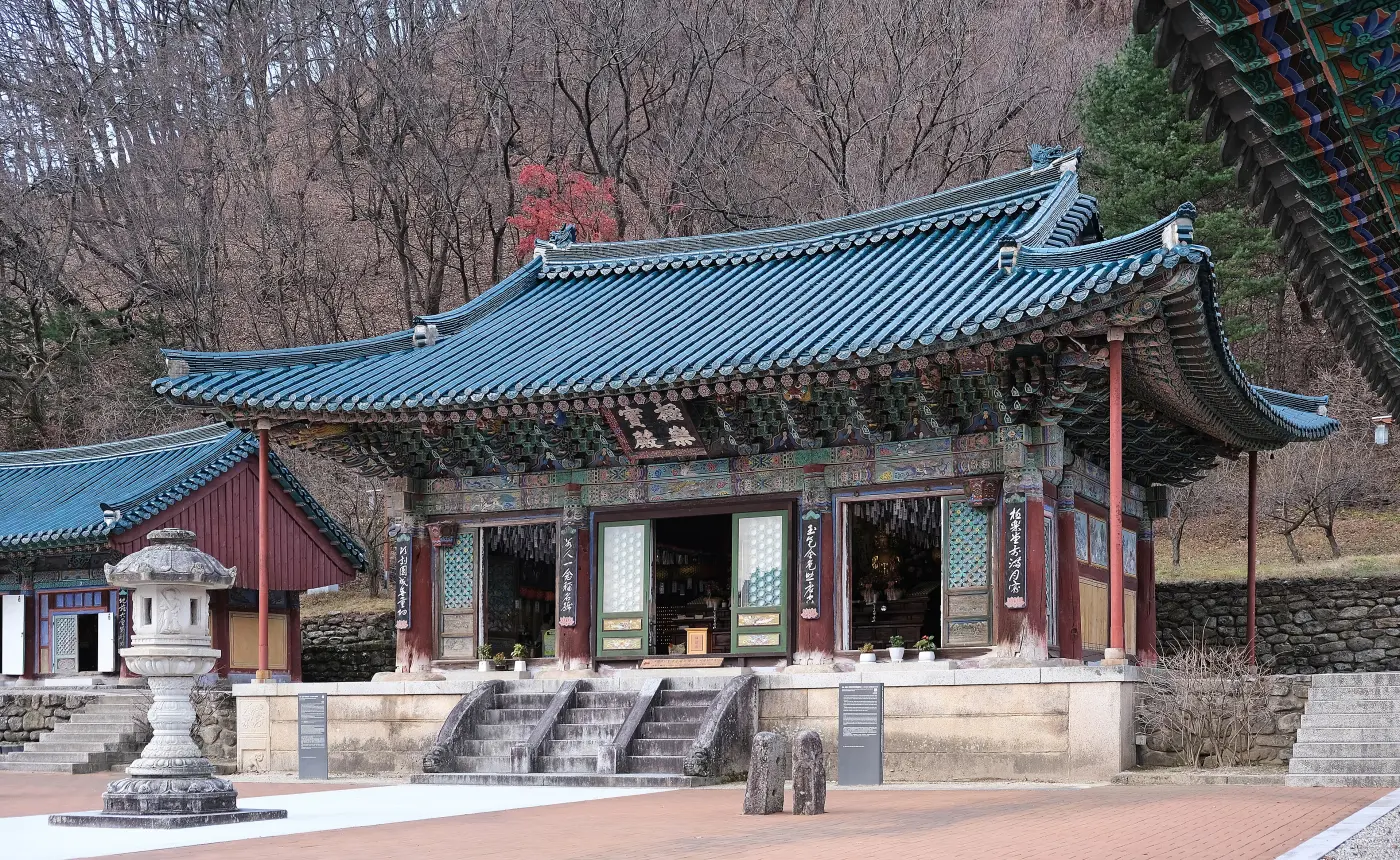
A short walk from Sogongwon, Sinheungsa is the Buddhist temple that most visitors pass on the way to the Ulsanbawi trail. Before you reach the gate, a very large bronze Buddha appears beside the path. Sokcho City records that it was made between 1987 and 1997 as a prayer for Korean reunification, and gives its height as 14.6 metres.
The older buildings are behind it. Sokcho City lists the main hall, Geungnakbojeon, as a late Joseon structure first built in 1649 and repaired in 1750 and 1821, and the long Bojeru pavilion in front of it as dating from 1644. The way into the main courtyard passes underneath Bojeru, a layout the city points out as one of the temple's architectural features. Dress modestly, keep your voice low, and do not photograph people at prayer. Temple etiquette and how to stay overnight at a temple are covered in our templestay guide.
Ulsanbawi: the classic half-day climb
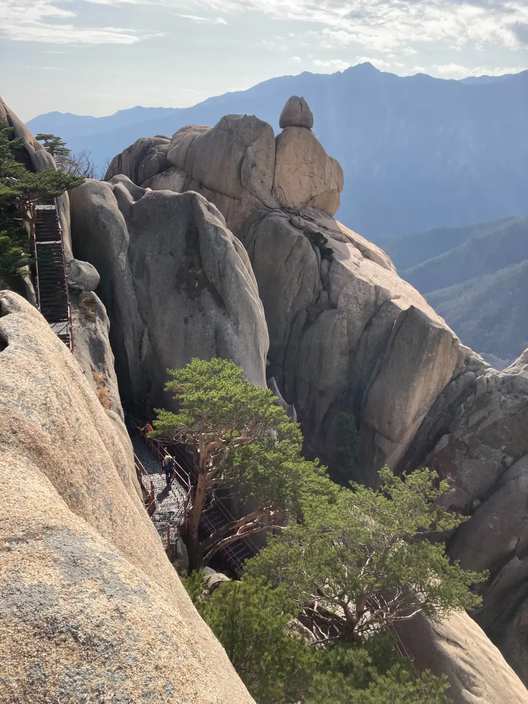
Ulsanbawi is a long ridge of granite towers, and KNPS calls the trail to it one of Seoraksan's signature routes. KNPS gives the route from Sinheungsa past Heundeulbawi, a large rocking boulder, to the top of Ulsanbawi as 3.8 km one way and about two hours, or 7.6 km and about four hours there and back.
The two halves are very different. The first 2.8 km, to Heundeulbawi and the small hermitage of Gyejoam, takes about an hour on a gently rising path of earth, stone and decking; KNPS describes it as manageable for children and older walkers. The last 1.0 km, from Heundeulbawi to the top, also takes about an hour because it is almost entirely steep steel staircases fixed to the rock. KNPS asks walkers to check how they feel before starting that section, and warns of rockfall risk near the top. If stairs are a problem, Heundeulbawi on its own is a worthwhile turnaround point.
KNPS recommends the route especially from mid-October to early November, when the rock and the autumn leaves are at their best. Bring water, a warm layer and something to eat: the park office notes that mountain weather can turn quickly, with sudden rain or a drop in temperature.
Biseondae and the gentler valley trails
If you want scenery without the stair climb, head up the valley to Biseondae instead. KNPS gives the walk from Sogongwon past Sinheungsa and Waseondae to Biseondae as 3.0 km and about 1 hour 20 minutes one way, mostly along the stream with some stone steps. The name comes from an old story that a heavenly maiden rose into the sky from the rocks and pools here. KNPS says this route suits children and older walkers, that about the first third has a nature trail usable by wheelchair users, and, importantly, that it stays open during the fire-prevention closure periods.
From Biseondae a side trail climbs 0.6 km, about 40 minutes, to Geumganggul, a natural cave high on the cliff. KNPS describes this as steep, ending in steel stairs, and lists the full round trip from Sogongwon at 7.2 km and about 3 hours 20 minutes. The park's entry-time rules say walkers may not start up toward Geumganggul from Biseondae after 14:00.
A third option from the same car park leads to two waterfalls. KNPS lists Sogongwon to Biryong Falls as 2.4 km and about an hour, with the first 1.2 km passable for strollers and wheelchairs, and a further 0.4 km of steep decking stairs, about 30 minutes, to a viewpoint facing Towangseong Falls. Sokcho City groups the Heundeulbawi, Biryong Falls and Biseondae walks together as the three easiest routes for beginners.
The cable car to Gwongeumseong
For a mountain view without a hike, the Seorak cable car runs from inside the Sogongwon area up to Gwongeumseong, a rocky summit at about 700 metres. Sokcho City explains the name: according to tradition, two generals surnamed Kwon and Kim built a fortress here in a single night in 1253 to resist the Mongol invasions. Only traces of the walls remain. From the upper station a short climb leads to the highest rocks, with views over the outer Seorak peaks and, on a clear day, the coast.
Three points from the city's page are worth knowing before you queue. Tickets are sold as round trips only, the cable car cannot be reserved, and it stops running in strong wind or bad weather. Fares and operating hours are set by the operator and change with the season, so check them on the day.
Rules and closures inside the park
Korean national parks are strict, and Seoraksan more than most. These are the rules that matter for a short visit:
- Daylight only. Under the park's entry-time system, the trails from Sogongwon to Ulsanbawi, the Towangseong Falls viewpoint, Biseondae and Gwongeumseong are closed from sunset until two hours before sunrise. Plan the longer walks so you are back before dark.
- Seasonal fire-prevention closures. In spring and autumn the high-altitude trails close to reduce the risk of forest fires. In 2026 the spring closure ran from 4 March to 15 May. In autumn 2025 the closure ran from 15 November to 15 December. The 2026 autumn notice had not been posted when this guide was written, so check the KNPS trail-control page before you go.
- Low trails usually stay open. During both closures KNPS kept the low-level routes open, including Ulsanbawi, the valley toward Biseondae and the Towangseong Falls viewpoint. The closures mostly affect people heading for Daecheongbong and the long ridge routes.
- No smoking, no fires, no cooking, and no leaving the marked trail. The park office's November 2025 announcement put fines for entering closed areas at 200,000 won for a first offence and higher for repeat offences, with larger fines for smoking or carrying flammable materials.
- Weather can close any trail at short notice, including during heavy rain, snow, typhoons and the spring thaw, when rockfall risk is higher.
For autumn colour more generally, our article on the best time to visit Korea explains how Korea's foliage forecast works and when Seoraksan usually turns.
Sokcho town: beach, Abai Village and the gaetbae
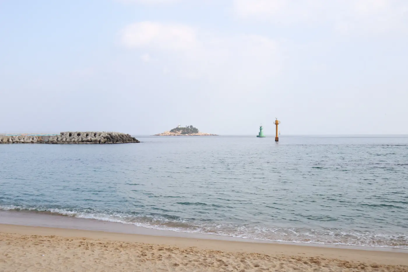
Back in town, Sokcho Beach is the easiest place to start. It is a long sandy beach with a pine-shaded promenade, about five minutes on foot from the express bus terminal. Sokcho City lists it as open year-round and free to enter; swimming is only allowed in the summer season and inside the marked buoys.
North of the beach, on the sandbar between the sea and Cheongcho Lake, is Abai Village. Sokcho City explains its story: during the Korean War, refugees from Hamgyeong Province in what is now North Korea settled here, expecting to return home soon, and built homes on the sand. "Abai" is the Hamgyeong dialect word for an older man. The village is still known for Hamgyeong-style food such as cold noodles and stuffed squid sundae, and the city says a local culture and tourism guide can be booked to explain its history.
To cross the narrow harbour channel between the village and downtown, take the gaetbae, a small ferry that passengers pull across by hooking onto a steel cable. Sokcho City says the refugees built it to reach the town centre. As of October 2026, the city lists the adult one-way fare as 500 won and the hours as 05:00 to 23:00 from May to October and 05:30 to 22:30 from November to April, subject to weather, and its walking-tour page mentions a ticket machine that takes cards. The crossing takes only a few minutes, and pets are not allowed on board.
Markets, Daepo Port and Yeonggeumjeong
From the downtown landing of the gaetbae, Sokcho City's walking map puts the Sokcho Tourist & Fishery Market a few minutes away. This is the town's traditional central market, organised into alleys by trade: fruit, chilli, sundae, salted seafood, and a whole alley of dakgangjeong, the sweet and spicy fried chicken that the city lists among Sokcho's signature foods. A basement hall sells raw fish; the city notes that the fish centre closes on the second Wednesday of each month.
Daepo Port, at the southern edge of town, is the other seafood stop. Sokcho City describes it as the southern gateway to Sokcho, with a fishery market and an alley of seafood fried snacks next to the harbour. A short walking path behind the port leads to a viewpoint where, the city says, you can see both the harbour and Ulsanbawi.
For the evening, walk to Yeonggeumjeong in Dongmyeong-dong, the rocky stretch of shore below the Sokcho lighthouse. The name refers to the sound of the waves on the rocks, said to resemble a geomungo, a Korean zither. A footbridge leads out to a pavilion on the rocks, and the city lists the spot as a sunrise and sunset viewpoint that is open at all hours. The lighthouse observatory is about ten minutes' walk away.
Where everything is, and how long to allow
| Place | What it is | How to get there | Time to allow |
|---|---|---|---|
| Sinheungsa | Buddhist temple at the Seorak-dong entrance, halls from the 1640s and a large bronze Buddha | City bus 7 or 7-1 to Sogongwon, then a short walk | 45–60 minutes |
| Ulsanbawi | Granite ridge; trail passes the Heundeulbawi rocking stone | On foot from Sogongwon via Sinheungsa, 3.8 km one way | About 4 hours round trip (KNPS) |
| Biseondae | Stream valley and rock basin; easier trail | On foot from Sogongwon, 3.0 km one way | About 2 hours 40 minutes round trip; add Geumganggul for 3 hours 20 minutes total (KNPS) |
| Biryong Falls / Towangseong viewpoint | Two waterfalls; first 1.2 km stroller-friendly | On foot from Sogongwon, 2.8 km one way to the viewpoint | About 3 hours round trip (KNPS) |
| Gwongeumseong (cable car) | Fortress ruins on a rocky summit at about 700 m | Cable car from inside Sogongwon; round-trip tickets only, no reservations | 1–2 hours, longer on busy autumn days |
| Sokcho Beach | Town beach with a pine promenade | About 5 minutes on foot from the express bus terminal | 30–60 minutes |
| Abai Village and gaetbae | Village founded by war refugees; hand-pulled cable ferry | On foot from downtown; the gaetbae crosses the harbour channel | 1–1.5 hours |
| Sokcho Tourist & Fishery Market | Traditional central market; dakgangjeong alley | A few minutes on foot from the gaetbae landing | About 1 hour |
| Daepo Port | Fishing harbour with seafood market and viewpoint | Southern edge of town; short taxi ride from downtown | 1–1.5 hours |
| Yeonggeumjeong | Rocky shore and pavilion below Sokcho lighthouse | On foot from downtown or Dongmyeong port | 30–60 minutes |
A one-night, two-day plan
This plan uses buses and walking only, and keeps the mountain for the morning when trails are quietest and you have the most daylight.
- Day 1, morning: take an early bus from Dong Seoul or Seoul Express Bus Terminal. Leave your bags at your accommodation, or at a locker if you are checking in later.
- Day 1, afternoon: walk to Abai Village, cross on the gaetbae and continue to the Sokcho Tourist & Fishery Market for a late lunch or a box of dakgangjeong.
- Day 1, evening: watch the light change over the sea at Yeonggeumjeong, then walk back along Sokcho Beach.
- Day 2, early: city bus 7 or 7-1 to Sogongwon. Visit Sinheungsa on the way in, then choose one walk: Ulsanbawi if you are fit and happy on stairs (about 4 hours), Biseondae for an easier valley walk (under 3 hours), or the cable car to Gwongeumseong if you would rather not hike.
- Day 2, afternoon: bus back to town, a seafood meal at the central market or Daepo Port, then an afternoon bus back to Seoul.
If you arrive in Sokcho early on day one, you can swap the days and go straight to the park, keeping the town for the second day. In the fire-prevention periods the plan still works, because the trails it uses are the low-level ones that normally stay open; in mid-autumn, expect queues for the bus and cable car and start earlier.
Before you go
Check three things the day before: the KNPS trail-control page for closures, the weather forecast for the mountains rather than for the coast, and your return bus seat. Wear shoes with real grip, because even the easier trails include stone steps, and carry cash or a T-money card as backup for small purchases. If you have done a hike or two around Seoul already, Seoraksan's low trails will feel familiar; the main difference is scale, and the fact that the sea is waiting at the bottom.
Comments
Sign in to leave a comment.
Sign in ·No account? Create one
Confirm your email address to comment — it takes one click.
No comments yet.